Events
An Event in the ATMS is a way of keeping record of and responding to adverse conditions affecting the normal flow of traffic on the managed road network. Alerts are used to broadcast information about missing persons.
The ATMS has categorized events and alerts into following major types:
| ICON | DESCRIPTION |
|---|---|
| Incident Possible causes: crash, debris on roadway, disabled vehicle, fire, hazardous material spill | |
| Congestion Possible causes: delay | |
| Planned Possible causes: road works, special events. | |
| Wrong Way Driver Possible causes: wrong way driver | |
| Wrong Way Driver Possible causes: wrong way driver | |
| Weather Possible causes: flooding, poor visibility, high winds, ice storm | |
| None | Missing Persons' Alerts Possible causes: Amber Alert, Silver Alert, Green Alert |
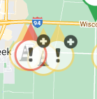
Overlapping Event Icons
For events that have icons that overlap (completely or significantly) on the map, the event icon shown on top will have a superimposed '+' to readily denote to users that there are multiple events at the location. Individual events maybe accessed by right-clicking on the top icon, as currently supported.

Event Map Filter
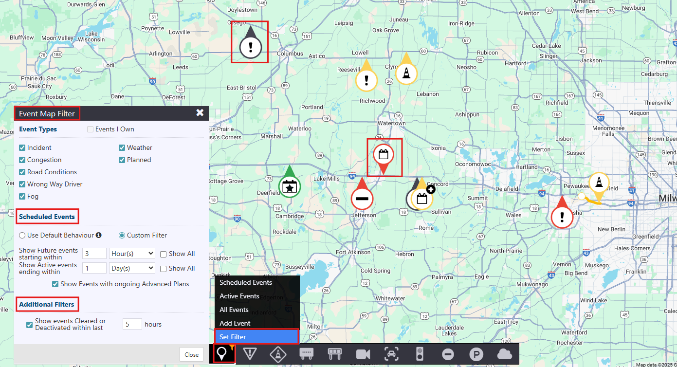
To view specific events on the map, click the Events icon in the action panel and select Set Filter.
In the Event Map Filter window, you can customize what events are displayed:
Event Types: Select or deselect the types of events you want to view (e.g., Incident, Planned, Weather).
Scheduled Events: Choose between Default Behavior or Custom Filter. With Custom Filter, you can:
Show future events starting within a specified number of hours.
Show active events ending within a specified number of days.
Optionally include events with ongoing Advanced Plans.
Additional Filters: Enable the option to show Cleared or Deactivated events within a set number of past hours.
Once filters are applied, the map updates accordingly. An orange filter icon will appear on the action panel to indicate that custom filters are active.
