Diversion Plans
Diversion Plan List
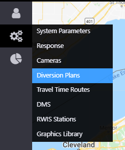
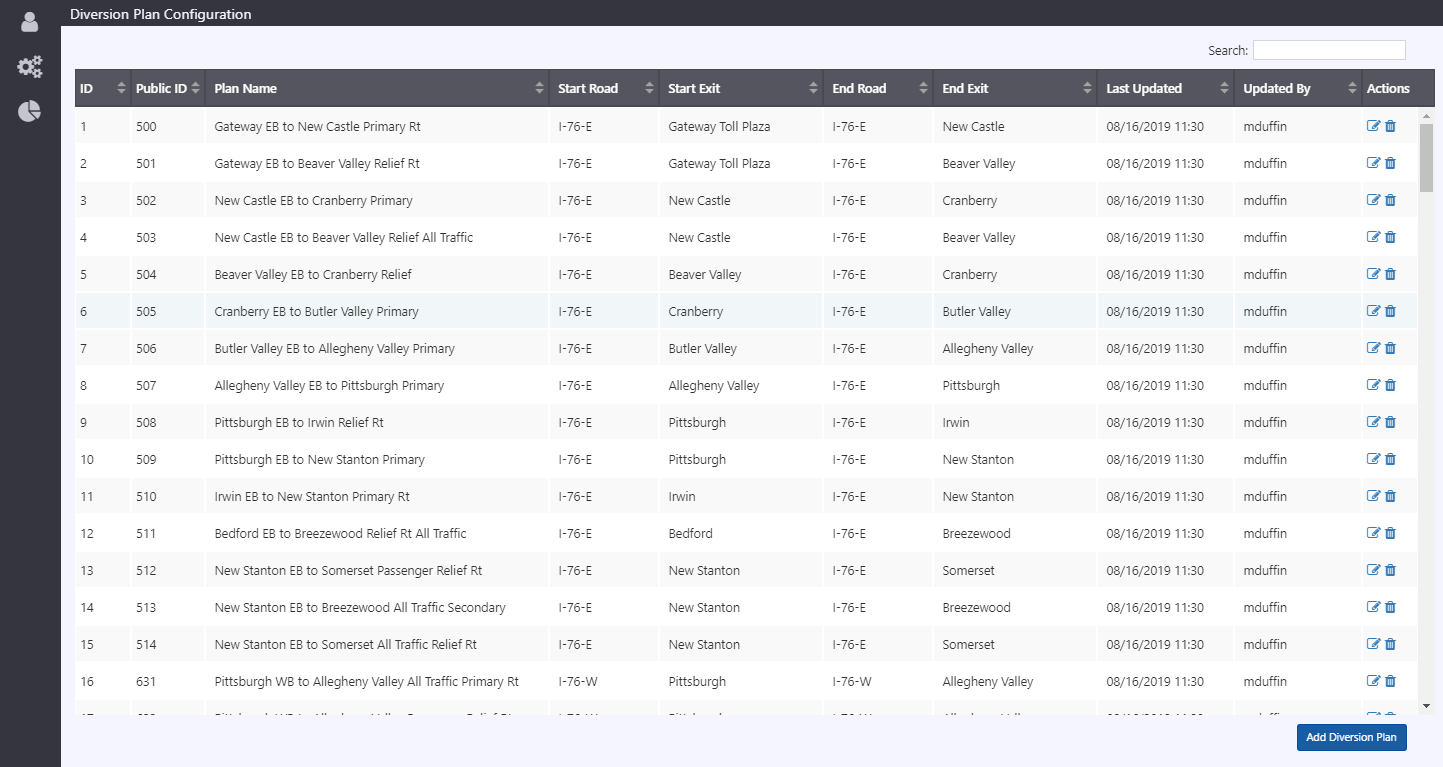
To access the Diversion Plan list, hover over the configuration icon in the navigation menu and select Diversion Plans. A window with a list of all diversion plans in the ATMS is populated.

The Diversion Plan List window lists all existing diversion plans. The list displays the following data:
- Display ID: the ID number within the Diversion Plan list
- Public ID: the ID number within the ATMS system
- Plan Name: the descriptive name for the diversion plan
- Start Road: the roadway on which the diversion route starts
- Start Exit: the exit on which the diversion route starts
- End Road: the roadway on which the diversion route ends
- End Exit: the exit on which the diversion route ends
- Last Updated: the last date and time the diversion route was updated
- Updated By: the user who last updated the diversion route

There are two actions available for a given diversion route:
- Edit: update the configuration settings for a diversion route
- Delete: delete the diversion route
Plan Configuration
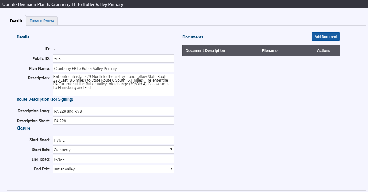
The Update Diversion Plan window has two tabs: Details and Detour Route.
Details
The Details tab displays the following information for a given diversion plan:
- Display ID: the ID number within the Diversion Plan list
- Public ID: the ID number within the ATMS system
- Plan Name: the descriptive name for the diversion plan
- Description: a detailed description of the diversion plan
- Description Long: the long-form diversion plan name to be output on a sign
- Description Short: the short-form diversion plan name to be output on a sign
- Start Road: the roadway on which the diversion route starts
- Start Exit: the exit on which the diversion route starts
- End Road: the roadway on which the diversion route ends
- End Exit: the exit on which the diversion route ends
- Add Document: allows the user to upload a document to be attached to the diversion plan (possible documents types are PDF, TIFF, JPEG, and DOC)

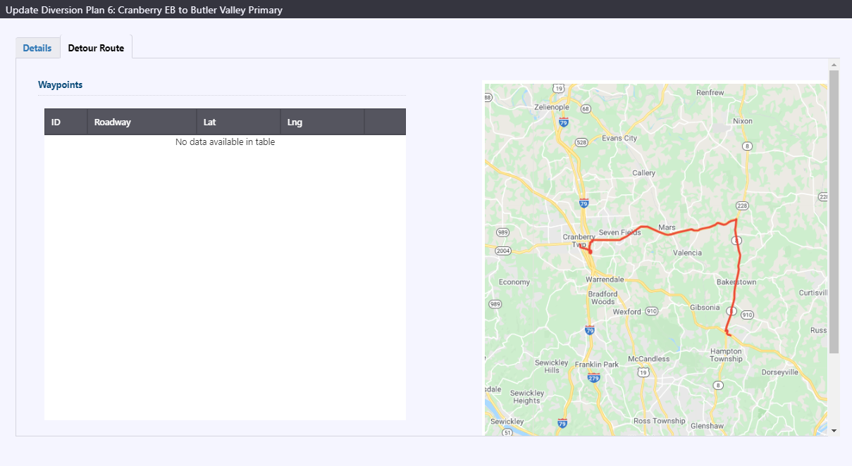
Detour Route
The Detour Route tab displays the following information for a given diversion plan:
- Waypoints: a table that displays the various points comprising the diversion plan, including their ID Numbers, Roadways, Latitude and Longitudinal coordinates
- Map: a map centered on the diversion plan for greater context
