RWIS
Configuration List
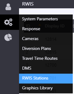
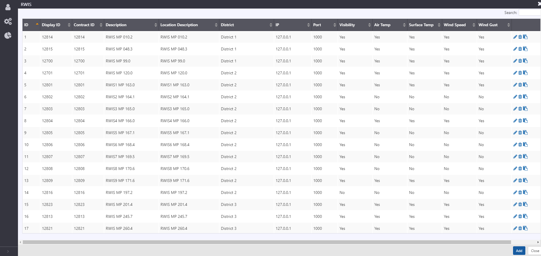
To access a list of all configured RWIS stations, hover over the configuration icon in the navigation menu and select RWIS Stations. A window with list of all stations configured in the ATMS is populated.
The configuration list window allows user to:
- view a list of configured stations. See section RWIS Configuration for description of information included
- add a new station by clicking the
button at the right bottom corner of the window
- delete an existing station
- edit configuration of an existing station
- copy configuration of an existing station and save as a new station
RWIS Configuration
Station configuration is easily accessible from an existing station, either from the right-click menu on a station, or through the menu at the right of the device in the Station List. The RWIS Configuration View allows authorized users to manage the configuration of each station, including general, communication, and supported measurements detail.
General
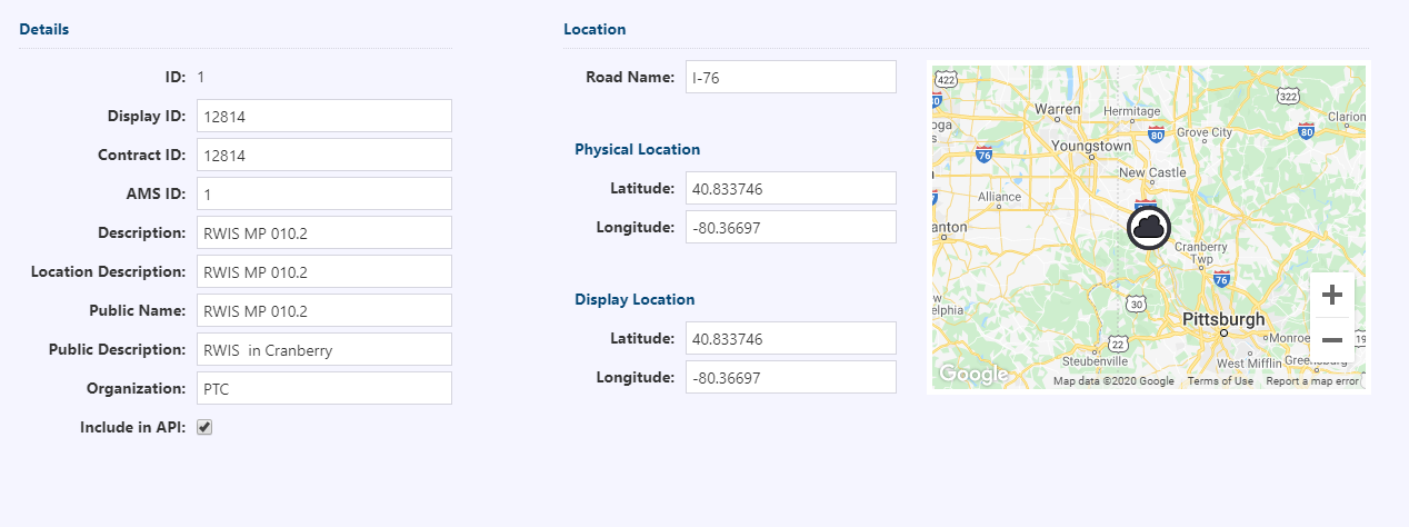
The general information of the station is entered on the 'General' tab, which includes a map presenting the location of the RWIS, which is updated as station coordinates are updated. The general information included for a station includes:
- ID: unique ID automatically assigned by the system upon creation
- Display ID: integer ID used for internal referencing of the stations
- Contract ID: string ID used for interfacing with an external system
- AMS ID: string ID used for interfacing with asset management system
- Description: description of the station
- Public Name: name used to refer to the station via ATMS API
- Public Description: description used to refer to the station in ATMS API
- Organization: string to describe what agency is responsible for the station
- Include in API: check box used to include station in API
- Road name: directional roadway associated with the device. Note, stations can also be assigned to the road 'other' to denote non-agency managed roadways
- Physical location: latitude and longitude for the physical location of the station
- Display location: latitude and longitude to use as the location for mapping
Communication
Information needed to determine communication to the station is entered on the 'Communication' tab. Communication to station is managed by the system, and only the IP address and port need to be supplied.
Communication includes:
Protocol: communication protocol to communicate with the station. Supported protocols include ViewMondo, Simulated Driver, Vaisala NTCIP, IceSight and NTCIP
noteFor ViewMondo devices, the IP and Port could be any valid value. Retrieve controller address from the API for respective device ID.
Connection Type: communication type options include UDP/TCP
Polling Interval (s): period of time between successive polls to a station
IP: device IP address
Port: port for device
Controller Address: HDLC address for multi-drop communication
Credentials:
- Get Community: The Get community string credential is required for communication. This string is only required for NTCIP communication.
Details
Supported measurements, and details are under 'Details' tab. Supported measurements allows for various road weather related measurement data to be enabled for collection with configurable threshold limits. Measurements such as air temperature, grip factor, surface temperature, visibility, wind gust, wind speed, relative humidity, subsurface temperature, dew point temperature, atmospheric temperature, precipitation scenario, precipitation rate, wind direction and pavement condition can be enabled for collection.
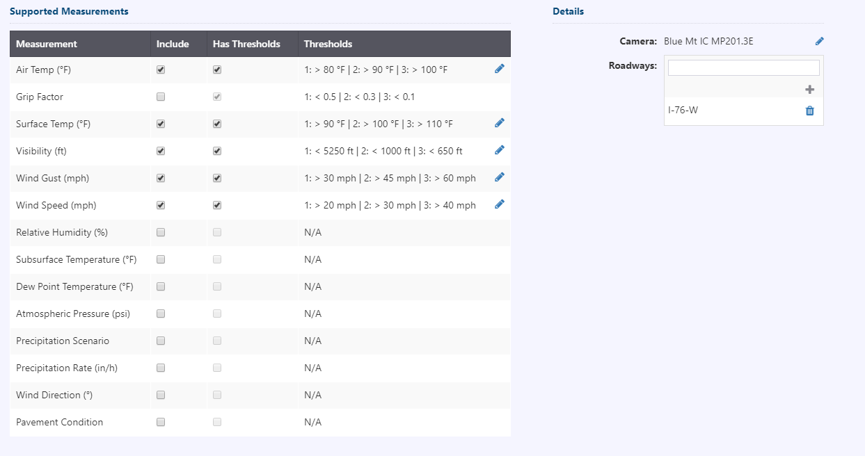
To edit threshold limits, click on for the measurement type. Threshold limit values can be entered in the new window shown below. Changes made can accepted or rejected.
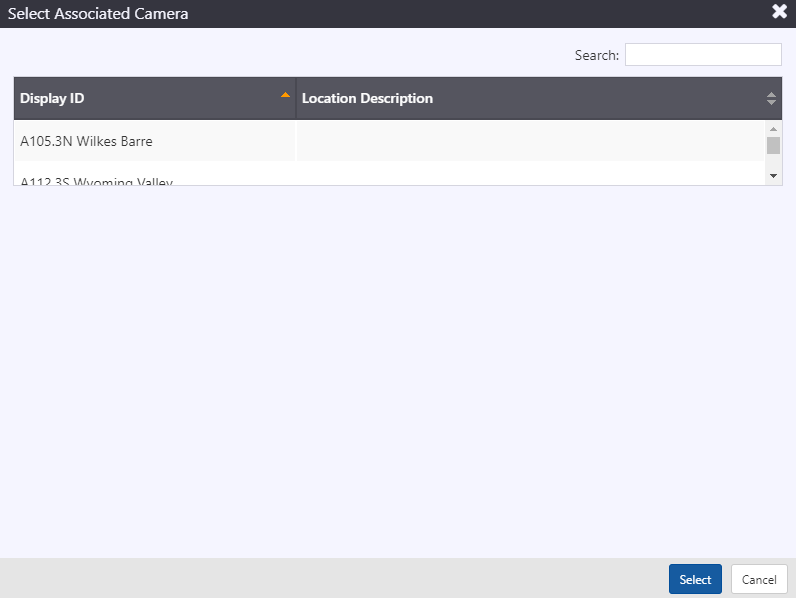
Details section allows for configuration selection of an associated camera. When a camera near the RWIS station can provide additional visual insight into the road/weather condition, it can be associated to a RWIS.
- Camera: To associate a camera to RWIS, click on
next to camera. Using display ID or search feature, a camera can be associated to a RWIS. When an associated camera is configured, View Camera option in the properties box will be enabled. Click on 'view camera' to show the latest still image from the camera feed.
- Roadways: Roadway segment(s) defined in the system that is monitored by this station.
